August 24th, 2020 | Updated September 2026 | Posted by: Grace Kim
Toketee Falls in Oregon is a 120-foot, two-tier waterfall on the North Umpqua River that you reach with a short 0.8-mile round-trip hike (and nearly 200 stairs) to a fenced viewing platform — free, no ticket needed. You can’t officially swim at Toketee Falls, since the pool at the bottom is only reachable by going past the safety fence, so below are my photos and first-hand notes from my August 2020 visit, plus what’s changed since.
Toketee Falls quick facts (2026)
- Where: Umpqua National Forest, off Highway 138 (the North Umpqua Highway), about 58 miles and 70 minutes east of Roseburg
- Hike: Toketee Falls Trail #1495 — 0.4 mile each way (0.8 mile round trip), about 120 feet of elevation gain and nearly 200 stairs
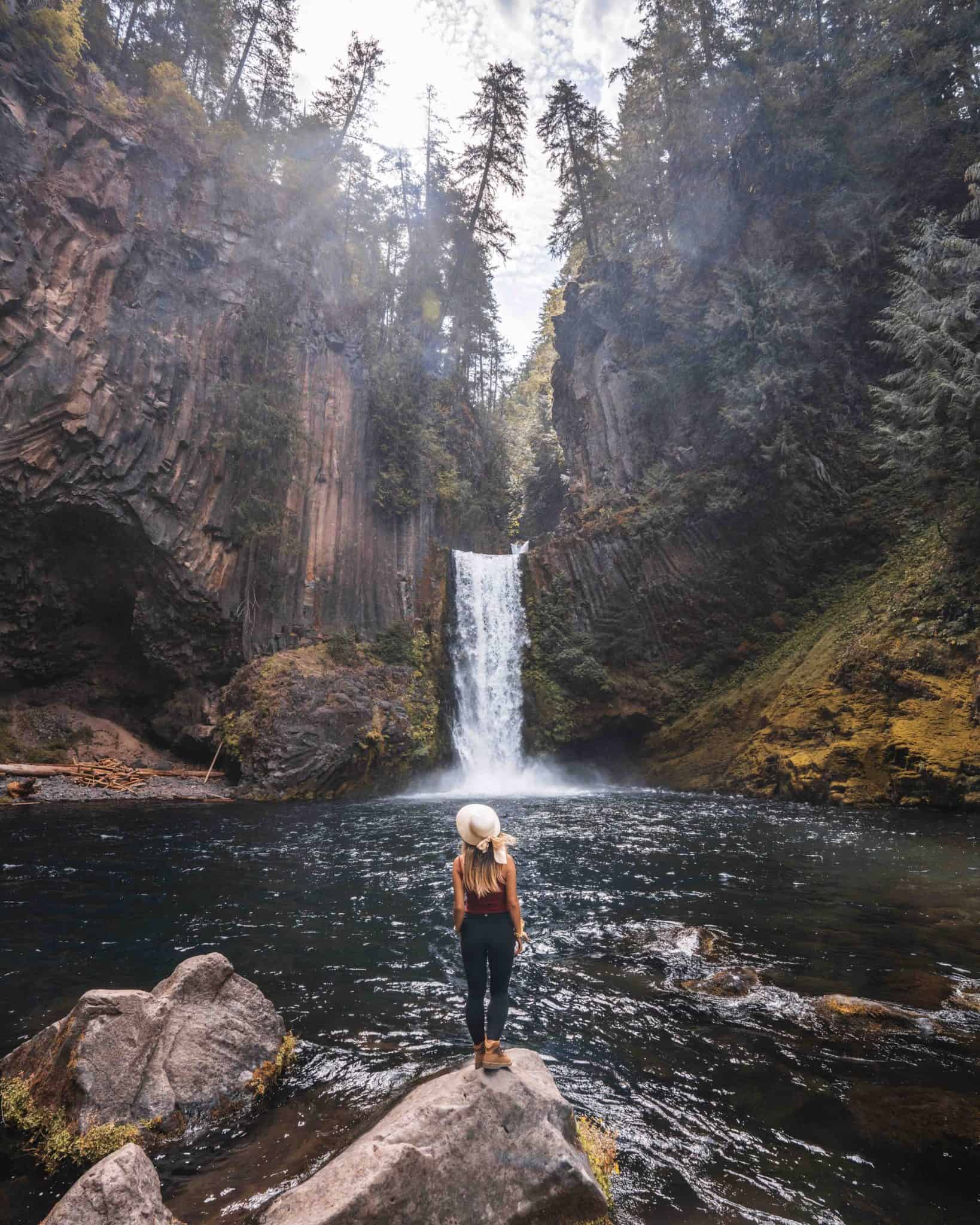
- The falls: about 120 feet total — an upper drop of about 40 feet and a lower drop of about 80 feet over columnar basalt
- Tickets and fees: none — parking is free and no pass is required
- Facilities: vault toilet and picnic tables at the trailhead; no drinking water and no trash cans on the trail
- Hours: day use only
- Swimming: no official access — the trail ends at a fenced viewing platform
- Dogs: allowed on leash
- Status: the Forest Service lists the trailhead as open (checked September 2026)
Let’s be real. Oregon is full of waterfalls, beautifully independent in their own ways. Some are easy to get to on flat land, and others not so easy if you’re looking for a refreshing swim.
Toketee Falls, one of Oregon’s most popular waterfalls, is located right off of Highway 138 and is hands down a must-go-to waterfall when visiting Oregon.
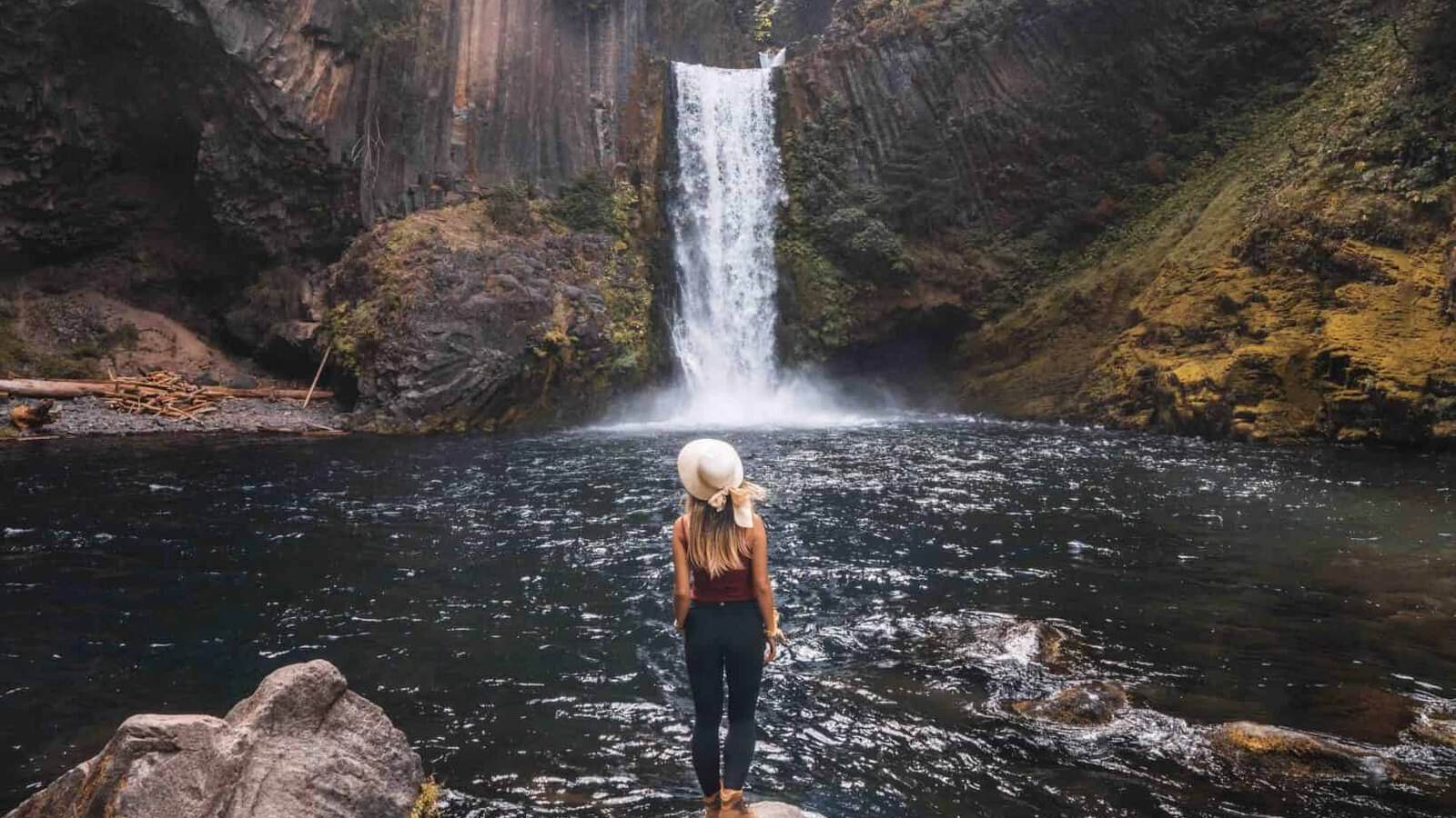
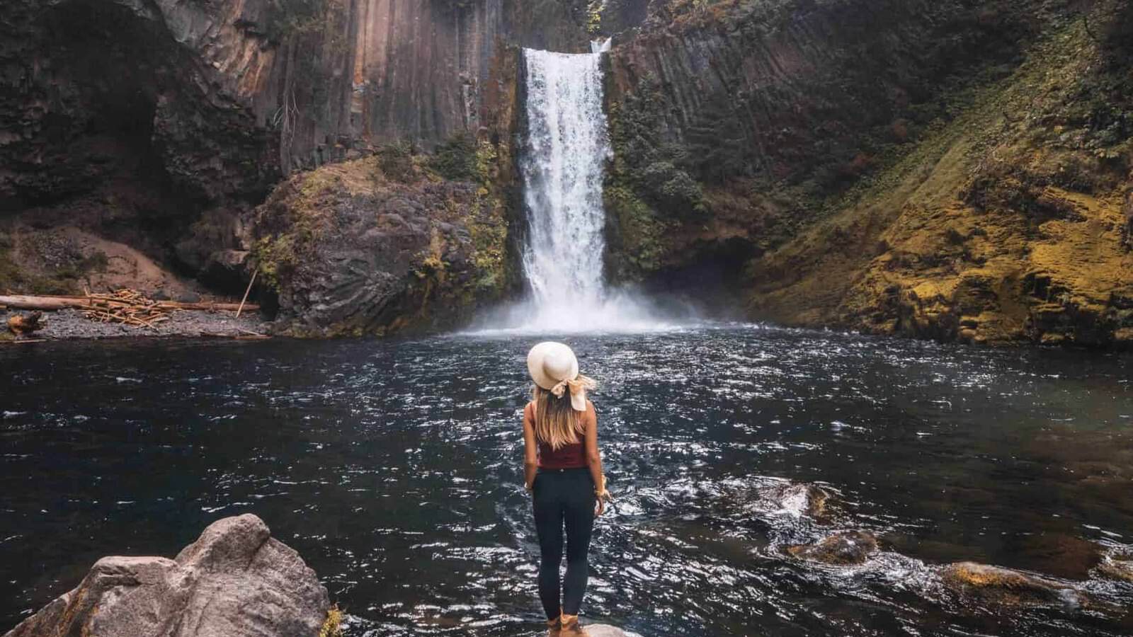
Toketee Falls is located on the North Umpqua River, carved from ancient basalt. The falls drop around 120 feet in two tiers, and there are a handful of angles to capture the falls throughout the day.
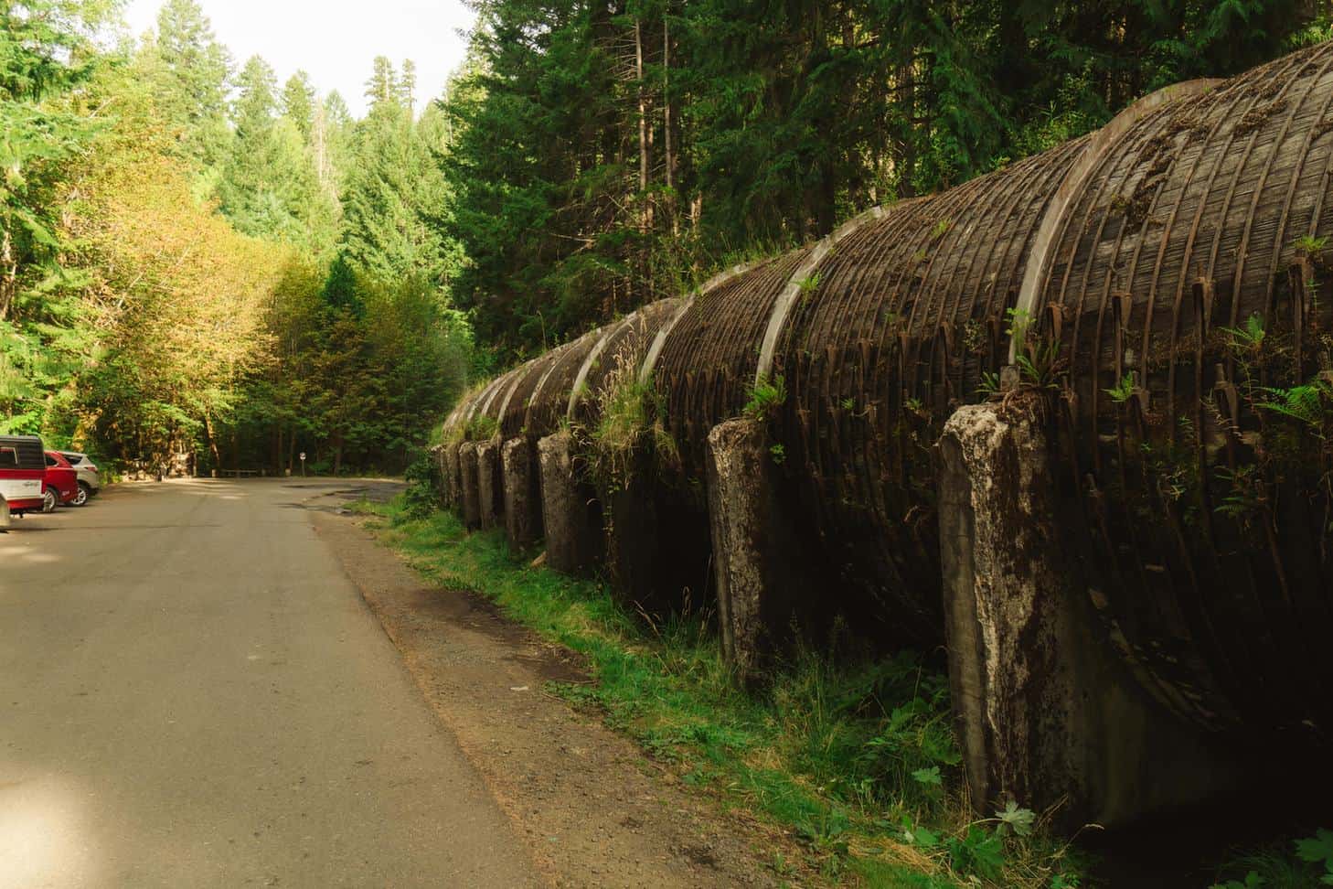
Parking is free and easy to find, but there are limited spots available. I’d recommend getting there as early as you can because the lot fills up quickly with cars eventually parking on the side of the huge water hydrant. You’ll know exactly what I’m referring to when you get there. (It’s actually a giant, leaky wooden pipeline that’s part of the North Umpqua hydroelectric project.)
When we parked for the falls, water was sprinkling out of what looked like a huge sprinkler. It’s extremely convenient because after coming out of the bathroom, you can wash your hands out in the open. Or, after the hike, it’s refreshing to rinse the dirt off your hands.
Before you ask about the climb, let’s start off with the basics of the hike to Toketee Falls.
>> Read More: The Ultimate Solo Travel Survival Guide
Where Is Toketee Falls? Directions & Parking
Toketee Falls is in the Umpqua National Forest in Douglas County, about 58 miles east of Roseburg (the closest mailing address is Idleyld Park, OR). From Roseburg, take Highway 138 east. At milepost 58.6, turn left onto Forest Road 34 (Toketee-Rigdon Road), keep left at the fork, cross the bridge over the North Umpqua River, and turn left right away into the trailhead parking. The trail starts at the far end of the lot.
Cell service gets spotty well before the turn, so download your map before you leave Roseburg or Crater Lake. You’ll need a car to get here.
Disclosure: The link below is an affiliate link. If you book through it, I may earn a commission at no extra cost to you.
If you’re flying in, you can compare rental cars on DiscoverCars.
All You Need to Know About Toketee Falls
Toketee Falls is a friendly hike as you will run into adults and kids alike. For most, it’s not an entirely strenuous hike, but you will catch yourself catching your breath since there are a handful of stairs you’ll need to climb to get to the end of the route. Round trip you’ll be encountering 97 steps up and 125 steps down with an elevation gain of about 120 feet.
There are bathrooms available before entering the trail, so you’re in luck if you headed to Toketee Falls right after catching sunrise at Crater Lake (it’s roughly an hour’s drive from the rim via the north entrance). There are also no garbage cans along the trail, so please pack out any trash you bring.
Round trip, you’re looking at a short 0.8 mile hike. Around 0.3 miles into the trail, you’re probably going to think that you’ve made it to the end, but just keep going. Walk until you reach a dead end as you’ll come across a viewing platform with circular fencing. Thankfully, if you need more time to catch your breath, there’s a bench about halfway along the trail to drink some water and to catch your breath.
Make sure to come early enough to take your selfies because it does get crowded with visitors. When we arrived, there were a number of solo travelers, couples, and families with kids.
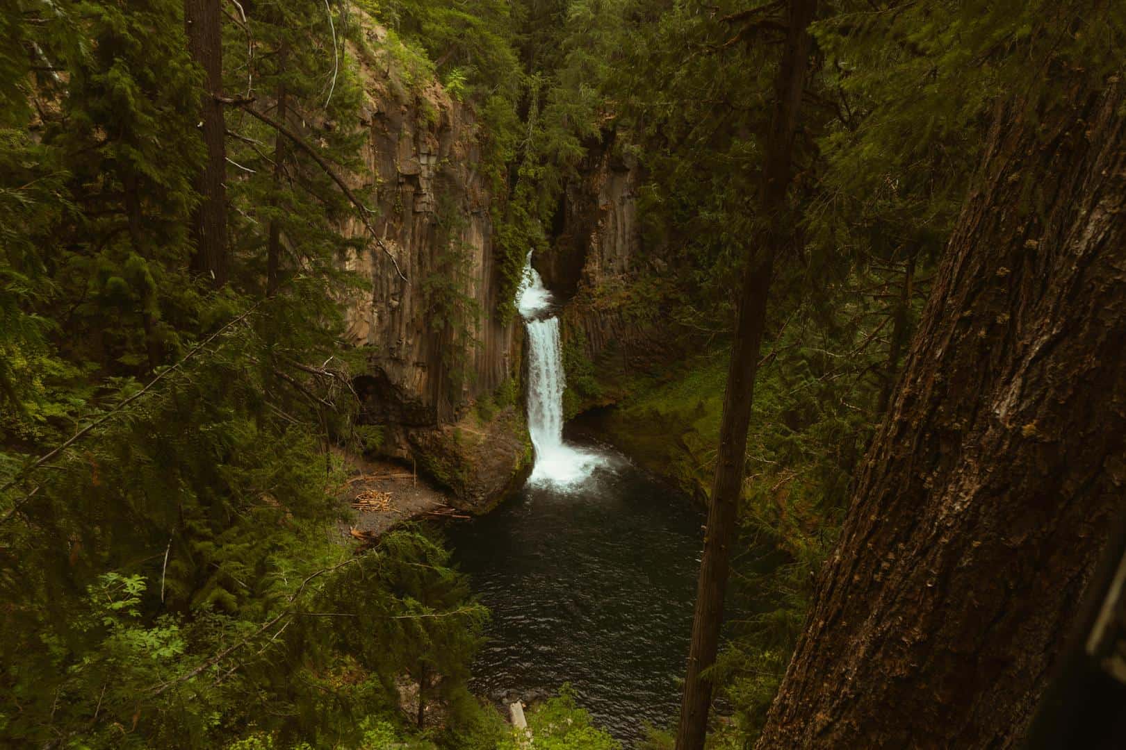
We visited Toketee Falls in August and the weather was absolutely perfect. If you’re planning on when to go, the best time to visit Toketee Falls is between Spring – Fall. The falls may be beautiful to visit during the winter, but the stairs and trail can get icy and snowy. I also do not recommend visiting after a storm or a rainfall because you’ll have a slippery experience with wet dirt. Plus, you don’t want to trip and fall along the hike.
Climbing Down Toketee Falls
2026 update: When I visited, lots of people were squeezing past the fence and using ropes to get down to the pool, and so did I. Since then, the Forest Service has been very clear that climbing over the safety fence is extremely dangerous, and people have been seriously hurt and killed here, including a 2025 rescue after a 40-foot fall. The official trail ends at the viewing platform, and that’s where I’d stop today. I’m keeping my story below because it’s part of my trip, not as directions.
Toketee Falls is beautiful in itself, no matter what angle you’re viewing it from. But I was dying to get closer to the water, so I wore clothes I didn’t mind getting dirty and made sure my camera gear was secure, so nothing got scratched and dusty.
Getting down meant a steep dirt hill with ropes, and I grabbed onto the rope, branches, or rocks at all times. Dust got all over me. Literally. All over my clothes, hands, face, hair, etc. It was extremely steep, and closed-toed shoes were a must.
Prior to going down, I actually saw someone climb down the rope barefoot with her camera in one hand and rope in the other. Wouldn’t recommend!
>> Read More: Exploring Cannon Beach, Oregon
At the Bottom of Toketee Falls
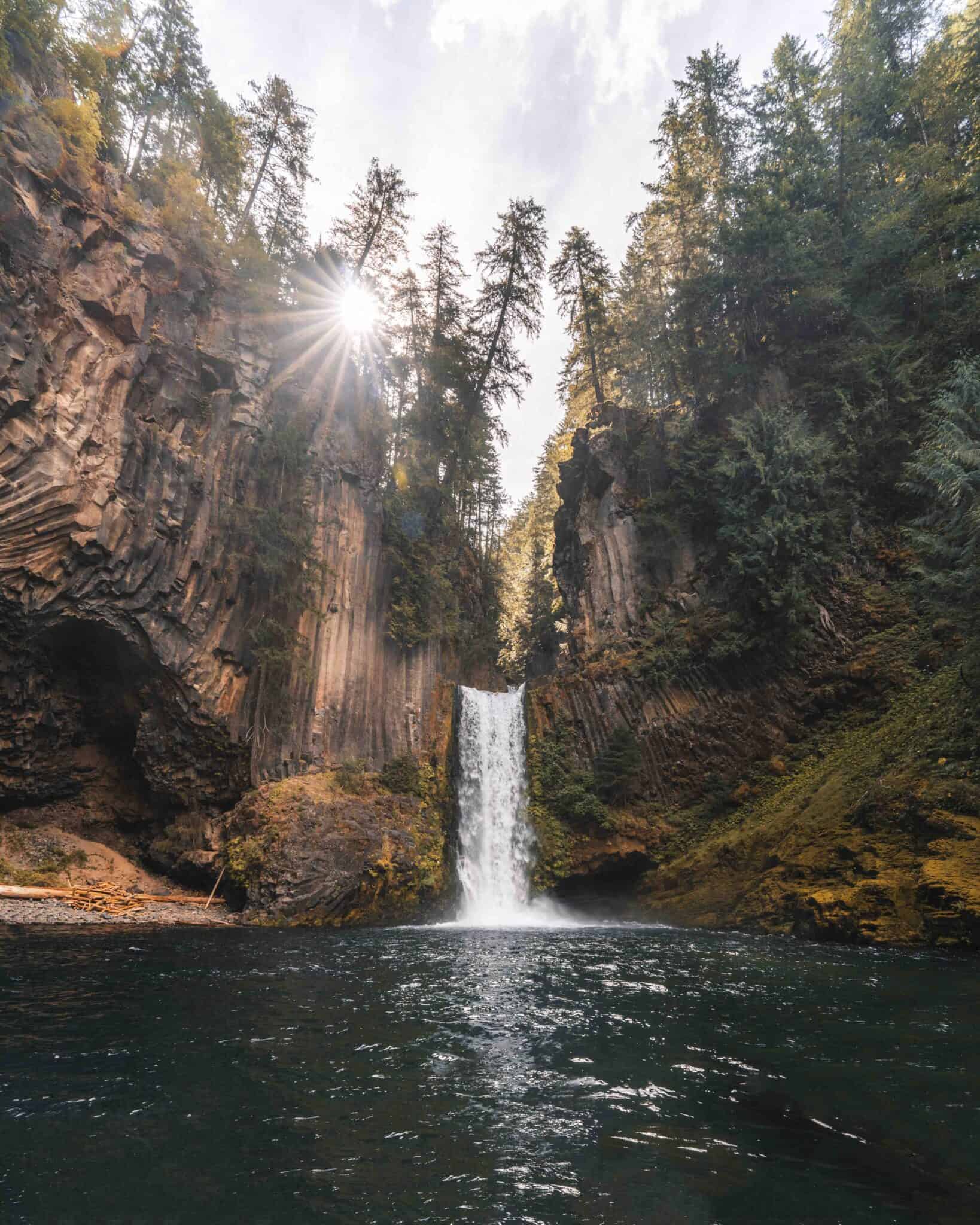
Woo! I made it back on flat land. A few feet headed towards the falls, I came across a huge tree blocking the way. I could either go under or above it. I went through the bottom, but saw people successfully getting over the top of the tree.
Once getting over the tree, you’ll start feeling the breeze from the water droplets falling onto the bottoms of Toketee Falls. There are a handful of rocks along the water to place your belongings and wash the dirt off your hands. Mind you that the water is extremely cold, but every sweat droplet running down your face was worth it in the end. Trust me.
Some people brought their bathing suits to swim. I was told that the water is extremely cold, so if you don’t have a towel, I wouldn’t advise swimming.
Drones are generally allowed here, since Toketee Falls is on national forest land. Not all waterfalls in Oregon permit drones, but if you’ve brought your drone with you, you’re in luck. Follow FAA rules, keep it away from the crowded viewing platform and trailhead, and check for wildfire flight restrictions before you launch. Capture Toketee Falls from all angles high and low and remember to fly early enough to get sun flares in your photos.
Is Visiting Toketee Falls Worth it?
All in all, I think you know the answer to this question. Hands down, yes. Toketee Falls is a beautiful waterfall and will definitely be a memorable spot during your visit to Oregon.
If you’re not in a rush and want to take your time exploring Toketee Falls, expect to spend 30 minutes to an hour on the trail and viewing platform (we took 1.5 – 2 hours because we climbed down). A group in front of us stayed to take no more than 5 photos and left but if you’re looking to take drone and long exposure shots, you’ll take more time than others.
Getting back up was also not as hard as getting down, but I gripped the ropes and branches the whole way. And as you’re finally nearing your car, remember to rinse your hands off at the water shooting out of the so-called water hydrant.
After exploring Toketee Falls, explore more of the area. Watson Falls is about two miles east on Highway 138, and Umpqua Hot Springs is about 3 miles up Forest Road 34 (day use only; $5 per vehicle or a Northwest Forest Pass). From the stairs through old-growth forest to the breeze hitting your face, visiting Toketee Falls will hands down solidify your Oregon experience.
Toketee Falls FAQ
Can you swim in Toketee Falls?
Not officially. The trail ends at a fenced viewing platform high above the pool, and the only way down is past the safety fence, which the Forest Service warns is extremely dangerous. The water is also very cold.
How long is the hike to Toketee Falls?
The Toketee Falls hike is 0.4 mile each way (0.8 mile round trip) with nearly 200 stairs and about 120 feet of elevation gain. Most people are back at the car in under an hour.
Can you hike to the bottom of Toketee Falls?
There’s no trail to the bottom. The maintained Toketee Falls trail ends at the viewing platform, the slope below it is steep and eroded, and the Forest Service asks visitors to stay on the trail.
Where is Toketee Falls?
Toketee Falls is in the Umpqua National Forest in southern Oregon, just off Highway 138 about 58 miles east of Roseburg. Turn onto Forest Road 34 at milepost 58.6.
Do you need tickets or a pass for Toketee Falls?
No. There are no tickets, and the Forest Service says no fees are required at the Toketee Falls trailhead. Parking is free.
Is Toketee Falls open?
As of September 2026, the Forest Service lists the Toketee Falls trailhead as open. Fires and winter weather can change that, so check the Umpqua National Forest alerts before you drive out.
When is the best time to visit Toketee Falls?
Late spring through fall. The trailhead sits around 2,400 feet, so the weather is cooler than in Roseburg, and the stairs can be icy in winter. Go early on a weekday to beat the crowds at the platform.
How tall is Toketee Falls?
About 120 feet: an upper drop of about 40 feet and a lower drop of about 80 feet.
Has anyone died at Toketee Falls? Did it collapse?
Sadly, yes, people have been seriously hurt and killed after going past the fence, which is why the Forest Service asks everyone to stay on the trail. The falls didn’t collapse, though; the trail and viewing platform are open.
How far is Toketee Falls from Crater Lake?
Roughly an hour’s drive from the rim when Crater Lake’s north entrance is open, so it’s an easy stop on the way to or from the park.
Where can you camp or stay near Toketee Falls?
Toketee Lake Campground is the closest campground (no overnight stays at the trailhead). I didn’t stay at these myself, but Steamboat Inn is the closest lodge on Highway 138, and Diamond Lake Resort works well if you’re continuing to Crater Lake. If the resort is full, compare other places to stay around Diamond Lake.
Disclosure: The two hotel links above are affiliate links. If you book through one, I may earn a commission at no extra cost to you.
Are there hot springs near Toketee Falls?
Yes, Umpqua Hot Springs is about 3 miles up Forest Road 34. It’s day use only, and parking costs $5 per vehicle unless you have a Northwest Forest Pass.
Are there other waterfalls near Toketee Falls?
Yes. Watson Falls is about two miles east on Highway 138, and this stretch of the North Umpqua Highway has several more waterfalls if you’re road-tripping toward Crater Lake.
What does “Toketee” mean?
Toketee is a Chinook Jargon word meaning “pretty” or “graceful.”
YOU MIGHT ALSO ENJOY…
- Things To Do in Cannon Beach
- Visiting the Airplane Home in Oregon
- Cool Things to Do in San Francisco
- The Ultimate Heart Lake Camping Travel Guide
- The Ultimate Solo Travel Survival Guide
- The Ultimate Crater Lake National Park Travel Guide
- 21 Most Popular Things to Do in Oregon
Pin This!

Leave a Reply